The Lake District’s most rewarding hiking experiences often lie beyond the crowded paths that dominate guidebooks and tourist maps. Hidden valleys, secluded tarns, and ancient tracks offer walkers a chance to discover the region’s authentic character whilst avoiding the masses that flock to popular peaks like Helvellyn and Scafell Pike. These lesser-known routes provide equally stunning scenery with the added benefit of solitude and genuine wilderness encounters.
Proper preparation becomes essential when venturing onto these remote trails, as they often lack the clear signage and well-maintained paths found on mainstream routes. Understanding local wildlife patterns, recognising unique flora, and appreciating the cultural heritage embedded in forgotten pathways enriches the hiking experience significantly.
The rewards for those willing to explore these hidden gems extend far beyond scenic photography opportunities. Walkers can discover pristine waterfalls tucked away in remote valleys, encounter native wildlife in their natural habitats, and walk in the footsteps of ancient civilisations along historic routes that mainstream tourism has overlooked.
Why Explore Lesser-Known Trails in the Lake District
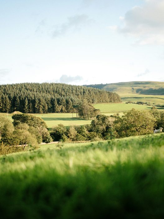
The Lake District’s hidden paths offer solitude amongst untouched landscapes and provide authentic encounters with the region’s natural heritage. These quiet routes reveal secret tarns, ancient woodlands, and panoramic viewpoints away from popular tourist destinations.
Unveiling Hidden Natural Beauty
Lesser-known trails lead to secret waterfalls tucked away in remote valleys. High Sweden Bridge offers cascading waters without the crowds of Aira Force. The path winds through native oak woodlands where red squirrels still thrive.
Secluded tarns await discovery on these quieter routes. Dock Tarn sits pristine above Watendlath, reflecting surrounding fells in crystal-clear waters. Few visitors venture beyond the main paths to find these hidden gems.
Ancient stone circles and burial cairns dot the landscape along forgotten tracks. These archaeological treasures remain undisturbed, offering glimpses into the area’s prehistoric past. The solitude allows for genuine contemplation of their historical significance.
Rare wildlife flourishes in these undisturbed habitats. Peregrine falcons nest on remote crags whilst golden eagles soar overhead. Native Herdwick sheep graze peacefully on fell sides, maintaining traditional farming practices that shaped the landscape.
Escaping the Crowds
Peak season brings thousands of visitors to popular routes like Helvellyn and Scafell Pike. Car parks overflow by 9 AM, creating lengthy queues on narrow mountain paths. The tranquillity that defines the Lake District becomes lost in the shuffle.
Hidden trails offer genuine solitude throughout the year. Walkers might encounter only a handful of people during entire day hikes. This creates opportunities for wildlife observation and photography impossible on busier routes.
Parking stress disappears when exploring lesser-known starting points. Small lay-bys and village car parks rarely reach capacity. The journey begins peacefully rather than with frustration over crowded facilities.
Local tea shops and pubs along quiet routes provide authentic experiences. These establishments serve genuine Cumbrian hospitality without tourist markup. Conversations with locals reveal insider knowledge about the area’s history and hidden treasures.
Preserving Pristine Landscapes
Popular trails suffer from severe erosion due to heavy foot traffic. Stone steps and artificial pathways increasingly replace natural terrain. The authentic fell-walking experience diminishes with each engineered intervention.
Lesser-known routes maintain their original character. Grass paths wind naturally through the landscape, unmarked by artificial improvements. These trails preserve the authentic hiking experience that drew early fell-walkers like Alfred Wainwright.
Flora diversity thrives away from trampled main routes. Rare orchids bloom in undisturbed meadows whilst ancient ferns carpet woodland floors. These delicate ecosystems require protection from excessive human impact.
Exploring hidden paths demonstrates responsible tourism. Distributing visitor pressure across multiple routes prevents over-use of fragile environments. This approach ensures future generations can experience the Lake District’s natural beauty in its intended state.
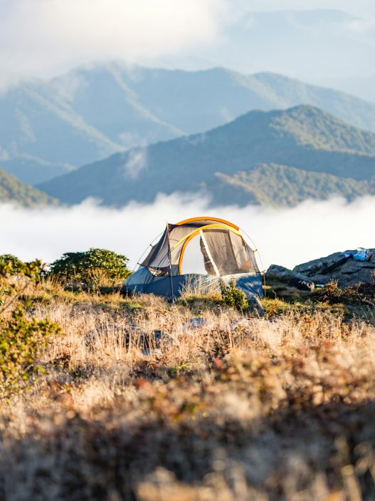
Essential Preparation for Off-the-Beaten-Path Hiking
Remote Lake District trails require proper navigation skills, appropriate equipment, and understanding of local weather patterns. These three elements form the foundation of safe exploration beyond marked paths.
Navigation and Safety Tips
Ordnance Survey maps remain essential for Lake District navigation. Hikers should carry OGL Explorer maps at 1:25,000 scale, which show detailed terrain features and field boundaries.
A compass provides backup navigation when GPS devices fail. Digital devices lose signal in valleys and drain batteries quickly in cold conditions.
Essential safety items include:
- Emergency whistle (six sharp blasts signals distress)
- First aid kit with blister treatment
- Emergency shelter or bivvy bag
- Headtorch with spare batteries
Mobile phone coverage varies significantly across the Lake District. Signal strength improves on ridges and high ground but disappears in many valleys.
Hikers should inform someone of their planned route and expected return time. Mountain rescue services recommend leaving detailed itineraries with emergency contacts.
Recommended Equipment and Gear
Waterproof boots with ankle support prove crucial on loose scree and boggy terrain. Leather boots offer durability whilst synthetic materials dry faster.
Layered clothing systems work best in changeable conditions. Base layers wick moisture, insulating layers trap warmth, and shell layers block wind and rain.
Essential gear checklist:
- Waterproof jacket and overtrousers
- Warm hat and gloves
- Gaiters for rocky terrain
- Trekking poles for stability
- 35-45 litre rucksack
Quality rain gear makes the difference between comfort and misery. Seam-sealed jackets with pit zips provide ventilation during climbs.
Food requirements increase on longer hikes. High-energy snacks and adequate water supplies prevent fatigue and dehydration.
Weather and Seasonal Considerations
Lake District weather changes rapidly, particularly at higher elevations. Conditions can shift from sunshine to rain within minutes.
Seasonal hiking conditions:
- Spring (March-May): Unpredictable weather, muddy paths, longer daylight
- Summer (June-August): Warmest period, afternoon thunderstorms possible
- Autumn (September-November): Shorter days, slippery leaves, beautiful colours
- Winter (December-February): Snow possible above 300m, limited daylight
Wind speeds increase dramatically with altitude. Exposed ridges become dangerous in strong winds, requiring route modifications.
The Met Office provides detailed Lake District forecasts. Mountain weather differs significantly from valley conditions, often being 10-15 degrees colder.
Dawn and dusk times vary considerably throughout the year. Winter hikes require early starts and conservative time estimates for safe completion.
Top Secluded Hikes for Scenic Views
These three remote trails offer dramatic fell views and peaceful valleys away from popular tourist routes. Each provides unique perspectives of the Lake District’s landscape through lesser-known paths.
Haystacks via Warnscale Beck
The Warnscale Beck route to Haystacks begins from Gatesgarth Farm near Buttermere. This 5-mile circular walk avoids the busier path from Honister Pass.
The trail follows the beck upstream through a narrow ravine. Walkers encounter several small waterfalls and moss-covered rocks along the way.
Key Features:
- Distance: 5 miles circular
- Ascent: 450 metres
- Duration: 3-4 hours
- Difficulty: Moderate
The final ascent opens onto Haystacks’ distinctive rocky summit at 597 metres. Views extend across Buttermere, Crummock Water, and the surrounding fells.
Innominate Tarn sits tucked between the rocky outcrops near the summit. This small mountain lake inspired Alfred Wainwright, whose ashes were scattered here.
Watendlath to Rosthwaite Circular
This 4-mile loop connects two picturesque Borrowdale villages through ancient woodland and open fell. The route starts from Watendlath’s tiny hamlet beside its reflective tarn.
The path descends through mixed woodland towards Rosthwaite. Stone bridges cross Watendlath Beck at several points along the valley floor.
From Rosthwaite, the return route climbs gradually up the fell side. Panoramic views emerge across Borrowdale valley towards Scafell Pike and Great End.
Navigation Notes:
- Follow yellow waymarkers through woodland
- Cross fields using stone stiles
- Path can be muddy after rainfall
The final descent back to Watendlath passes through heather moorland. Herdwick sheep graze freely across these traditional fell pastures.
High Street Roman Road
High Street follows an ancient Roman road connecting Ambleside to Penrith across the fells. The 8-mile route reaches 828 metres at its highest point.
The path begins at Hartsop village near Ullswater. Initial sections follow traditional dry stone walls through pastoral farmland.
Higher sections traverse exposed moorland with minimal shelter. Weather conditions can change rapidly at this altitude, requiring proper preparation.
Essential Equipment:
- Waterproof clothing
- Map and compass
- Emergency whistle
- First aid kit
Views from High Street’s broad ridge encompass Windermere, Coniston Water, and the Pennines. On clear days, visibility extends to the Scottish borders and Irish Sea.
The descent options include Mardale Head or returning via Hartsop. Both routes offer different perspectives of the surrounding landscape.
Discovering Hidden Waterfalls and Remote Lakes
The Lake District harbours spectacular waterfalls and secluded tarns away from crowded tourist routes. These destinations require moderate hiking effort but reward visitors with pristine natural beauty and peaceful surroundings.
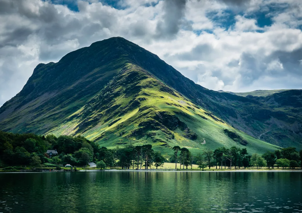
Scale Force and Crummock Water
Scale Force stands as the Lake District’s highest waterfall at 52 metres. The cascade plunges dramatically down a rocky ravine between Crummock Water and Buttermere.
The walk begins from Buttermere village, following the western shore of Crummock Water. A clear path leads north for approximately 2 kilometres along the lakeside.
Key Details:
- Distance: 4 kilometres return
- Duration: 2-3 hours
- Difficulty: Moderate
- Best viewing: After rainfall
The final approach involves scrambling over loose rocks and crossing a small stream. The waterfall appears suddenly through the trees, creating an impressive sight as it crashes into the pool below.
Crummock Water itself offers excellent views back towards the surrounding fells. The combination of the thundering waterfall and the serene lake creates a perfect contrast for photographers.
Blea Tarn and Lingmoor Fell
Blea Tarn sits nestled between the Langdale Pikes and Side Pike at 200 metres elevation. This small mountain lake provides classic Lake District scenery with minimal crowds.
The route starts from the car park near Blea Tarn House on the minor road between Great and Little Langdale. A gentle path leads directly to the tarn in 15 minutes.
Route Options:
- Direct route: 1 kilometre, 30 minutes
- Via Lingmoor Fell: 5 kilometres, 3-4 hours
- Circular walk: 3 kilometres, 2 hours
The tarn reflects the surrounding peaks perfectly on calm days. Pike o’ Blisco dominates the eastern view, whilst the Langdale Pikes rise to the north.
Extending the walk to Lingmoor Fell summit adds spectacular panoramic views. The ascent gains 300 metres over 2 kilometres, revealing views across the entire Langdale valley system.
Sprinkling Tarn from Seathwaite
Sprinkling Tarn occupies a dramatic position high in Seathwaite valley beneath Scafell Pike. This remote mountain lake sits at 460 metres elevation, surrounded by England’s highest peaks.
The walk begins from Seathwaite Farm, following the well-marked path towards Styhead Tarn. After 2 kilometres, a less obvious track branches left towards Sprinkling Tarn.
Navigation Notes:
- Follow stone cairns carefully
- Path becomes indistinct after Styhead Gill
- OS map essential in poor weather
The tarn appears suddenly after crossing a small col. Great End towers directly above, whilst Scafell Pike dominates the southern horizon.
This location offers genuine wilderness character despite its accessibility. The surrounding crags and boulder fields create an alpine atmosphere unique in the Lake District.
The return journey provides different perspectives of the Borrowdale valley. Allow 5-6 hours for the complete 8-kilometre round trip.
Wildlife Encounters and Unique Flora
The Lake District’s lesser-known paths harbour red squirrels, peregrine falcons, and diverse plant species. Quiet valleys shelter rare orchids and ancient woodlands support unique ferns.
Spotting Native Animal Species
Red squirrels inhabit the coniferous forests around Grizedale and Whinlatter. Early morning hikers spot them most frequently between 7-9 AM. They favour pine and larch trees.
Peregrine falcons nest on remote crags throughout the fells. Helvellyn’s eastern face and Scafell Pike’s northern cliffs provide excellent viewing opportunities. Binoculars enhance distant observations.
Roe deer graze in secluded valleys like Borrowdale’s upper reaches. They emerge at dusk near woodland edges. Patient observers find them along quiet bridleways.
Common sightings include:
- Buzzards circling above open moorland
- Dippers fishing in fast-flowing becks
- Herdwick sheep on traditional grazing lands
- Stoats hunting amongst stone walls
Rare Plants in Quiet Valleys
Alpine plants thrive on high fell ledges above 600 metres. Moss campion forms pink cushions on Helvellyn’s ridges. Mountain avens grows in limestone crevices around Arnside Knott.
Woodland valleys shelter uncommon ferns and flowers. Hart’s-tongue fern colonises damp stone walls in Borrowdale. Wood anemone carpets ancient oak woodlands each spring.
Bog plants flourish in waterlogged areas. Sundew traps insects on Claife Heights’ marshy ground. Cotton grass waves across wet moorland plateaus.
Notable species by habitat:
| Habitat | Species | Best locations |
|---|---|---|
| High fells | Parsley fern | Scafell range |
| Woodlands | Wild garlic | Grasmere woods |
| Wetlands | Bog asphodel | Tarn Hows area |
Cultural Heritage Along Forgotten Paths
The Lake District’s quieter trails lead to Castlerigg Stone Circle and Swinside Stone Circle, both predating Stonehenge by centuries. Remote villages like Troutbeck and Hawkshead preserve traditional Lakeland architecture and customs away from tourist crowds.
Historic Stone Circles and Ancient Sites
Castlerigg Stone Circle stands on a hilltop near Keswick, accessible via a gentle 20-minute walk from the town centre. This 5,000-year-old monument contains 38 standing stones arranged in a 93-foot diameter circle.
The site offers panoramic views of Helvellyn and Skiddaw. Early morning visits provide the best lighting for photography and fewer crowds.
Swinside Stone Circle lies in the Duddon Valley, requiring a 15-minute walk across farmland from the nearest parking area. This well-preserved circle features 52 granite stones, with only one missing from the original formation.
Bronze Age cairns dot the surrounding fells, including Beacon Tarn and White Moss Common. These burial mounds often sit along ancient trade routes connecting coastal settlements to inland communities.
The Langdale Axe Factory remains scattered across the Pike of Stickle. Neolithic people quarried volcanic rock here to create tools traded across Britain and Ireland.
Traditional Lakeland Villages
Troutbeck village maintains its original linear settlement pattern, with 17th-century farmhouses lining the valley floor. Townend, a National Trust property, showcases traditional yeoman farmer lifestyle with original carved furniture and domestic items.
The village’s Jesus Church dates to 1736 and contains rare three-decker pulpit arrangements. Traditional dry-stone walls and Herdwick sheep farming continue unchanged for centuries.
Hawkshead preserves medieval street layouts with grammar school where William Wordsworth studied from 1779 to 1787. The Beatrix Potter Gallery occupies her husband’s former solicitor’s office, displaying original illustrations and manuscripts.
Slate-built cottages feature characteristic Lakeland green paintwork and Westmorland slate roofs. Traditional spinning galleries remain visible on many buildings, where wool processing occurred during harsh winters.
Responsible Exploration and Leave No Trace
The Lake District’s fragile ecosystems require careful protection through proper hiking practices and active support for conservation efforts. Visitors can preserve these landscapes for future generations by following established guidelines and contributing to local environmental programmes.
Minimising Environmental Impact
Hikers should stick to established footpaths to prevent soil erosion and damage to native vegetation. The National Trust maintains most trails in the Lake District, and straying from these paths can create permanent scars on hillsides.
Essential Leave No Trace Practices:
- Pack out all rubbish, including biodegradable items like banana peels
- Use established campsites rather than wild camping where prohibited
- Keep dogs on leads near livestock and during bird nesting season (March-July)
- Avoid picking flowers, berries, or disturbing wildlife
Water sources require special attention in the Lake District. Hikers should collect water at least 60 metres from lakes and streams. Biodegradable soap still harms aquatic ecosystems, so washing should occur well away from water bodies.
Stone cairns and rock balancing damage fragile fell environments. Visitors should avoid building these structures, as they can mislead other hikers and disrupt natural habitats for small creatures.
Supporting Local Conservation Initiatives
The Lake District Foundation coordinates numerous conservation projects that visitors can support directly. Their work includes path restoration, woodland management, and wildlife habitat protection across the national park.
Voluntary organisations like Fix the Fells rely on donations and volunteer labour to maintain the region’s 3,000 kilometres of footpaths. Hikers can contribute through their website or participate in weekend work parties.
Key Conservation Groups:
- Cumbria Wildlife Trust – Manages nature reserves and species protection
- National Trust – Maintains 25% of the Lake District including major fells
- Friends of the Lake District – Campaigns for landscape protection
Local businesses often support conservation through percentage-of-sales donations. Choosing accommodations and gear shops that contribute to environmental causes helps fund ongoing protection efforts.
The Lake District National Park Authority operates ranger services that monitor sensitive areas and educate visitors. Reporting wildlife sightings or path damage to rangers helps them prioritise conservation work effectively.
Frequently Asked Questions
These answers cover lesser-known trails, mapping resources, scenic viewpoints, beginner routes, multi-day adventures, and challenging climbs throughout the Lake District’s diverse terrain.
What are some less trodden scenic hiking trails in the Lake District?
The Wainwright walk to Haystacks from Buttermere offers stunning views without the crowds found on Helvellyn or Scafell Pike. This moderate 5.5-mile circular route provides panoramic vistas across the western fells.
Blea Tarn from Little Langdale presents a gentle 3-mile walk through peaceful valleys. The path leads to a secluded tarn with reflections of the Langdale Pikes.
Tarn Hows from Hawkshead follows quiet woodland paths to one of the Lake District’s most photographed locations. Early morning visits typically ensure fewer visitors and better light for photography.
The ascent of Catbells from Keswick via the western approach attracts fewer walkers than the standard route. This alternative path offers equally spectacular views across Derwentwater.
Where can one find detailed maps for self-guided hikes in the Lake District?
Ordnance Survey Explorer maps 1:25,000 scale provide the most comprehensive detail for Lake District hiking. Maps OL4, OL5, OL6, and OL7 cover the entire national park area.
The Wainwright Pictorial Guides offer hand-drawn maps with detailed route descriptions for 214 fells. These seven volumes remain the definitive walking guides for the region.
Harvey Maps produce waterproof walking maps specifically designed for outdoor use. Their Lake District series includes detailed contour information and clear path markings.
Digital mapping apps like OS Maps and ViewRanger provide GPS navigation with offline map downloads. These platforms include route planning tools and real-time location tracking.
Which hike in the Lake District offers the most picturesque views?
The ridge walk from Buttermere to Red Pike delivers exceptional panoramic views across multiple valleys. This 6-mile route encompasses views of Buttermere, Crummock Water, and the Solway Firth.
Striding Edge to Helvellyn summit provides dramatic alpine-style scenery with views extending to Scotland on clear days. The exposed ridge section offers unparalleled mountain vistas.
The circuit of Tarn Hows combines woodland, water, and fell views in a compact 1.5-mile walk. This accessible route showcases classic Lake District scenery without significant elevation gain.
Great Langdale’s Pavey Ark via Jack’s Rake presents stunning views down the valley towards Windermere. The scrambling route rewards hikers with dramatic cliff-top perspectives.
Could you recommend some beginner-friendly walks in the Lake District?
The Windermere shoreline path from Bowness to Ambleside covers 3.5 miles of gentle lakeside walking. This flat route follows well-maintained paths with regular refreshment stops.
Grasmere village circular walk encompasses Dove Cottage and Rydal Water over 2 miles. The terrain remains relatively flat with clear path markings throughout.
Buttermere lake circuit offers a 4.5-mile walk around one of the Lake District’s most beautiful lakes. The path stays level with minimal elevation gain and spectacular mountain reflections.
Coniston Water’s eastern shore provides a 5-mile linear walk with optional return by steam yacht. The route follows clear paths with views across the lake to the Old Man of Coniston.
What multi-day walking routes are available in the Lake District for experienced hikers?
The Cumbria Way spans 70 miles from Ulverston to Carlisle across varied terrain. This 5-7 day route passes through the heart of the Lake District with accommodation available in villages along the way.
The Dales Way covers 84 miles from Ilkley to Bowness-on-Windermere over 6-8 days. The final section traverses the eastern Lake District through Kentmere and Troutbeck valleys.
The Coast to Coast Walk’s western section includes 30 miles through the Lake District. This portion typically requires 2-3 days and includes ascents of several significant peaks.
A circular tour of the central fells can be completed over 3-4 days using youth hostels and hotels. This self-planned route allows flexibility whilst covering major summits like Helvellyn and Scafell Pike.
What are the most challenging routes for seasoned hikers in the Lake District?
The Scafell Pike via Broad Stand scramble demands technical climbing skills and head for heights. This Grade 1 scramble requires careful route-finding and experience with exposed rock.
Sharp Edge on Blencathra presents a knife-edge ridge with significant exposure on both sides. The route requires scrambling ability and confidence on loose rock in potentially wet conditions.
Jack’s Rake on Pavey Ark offers a sustained Grade 1 scramble up a diagonal fault line. The route demands careful foot placement and becomes treacherous when wet or icy.
The Helvellyn horseshoe incorporating Striding Edge and Swirral Edge covers 8 miles with 3,000 feet of ascent. This classic route includes two exposed ridge sections requiring scrambling experience.